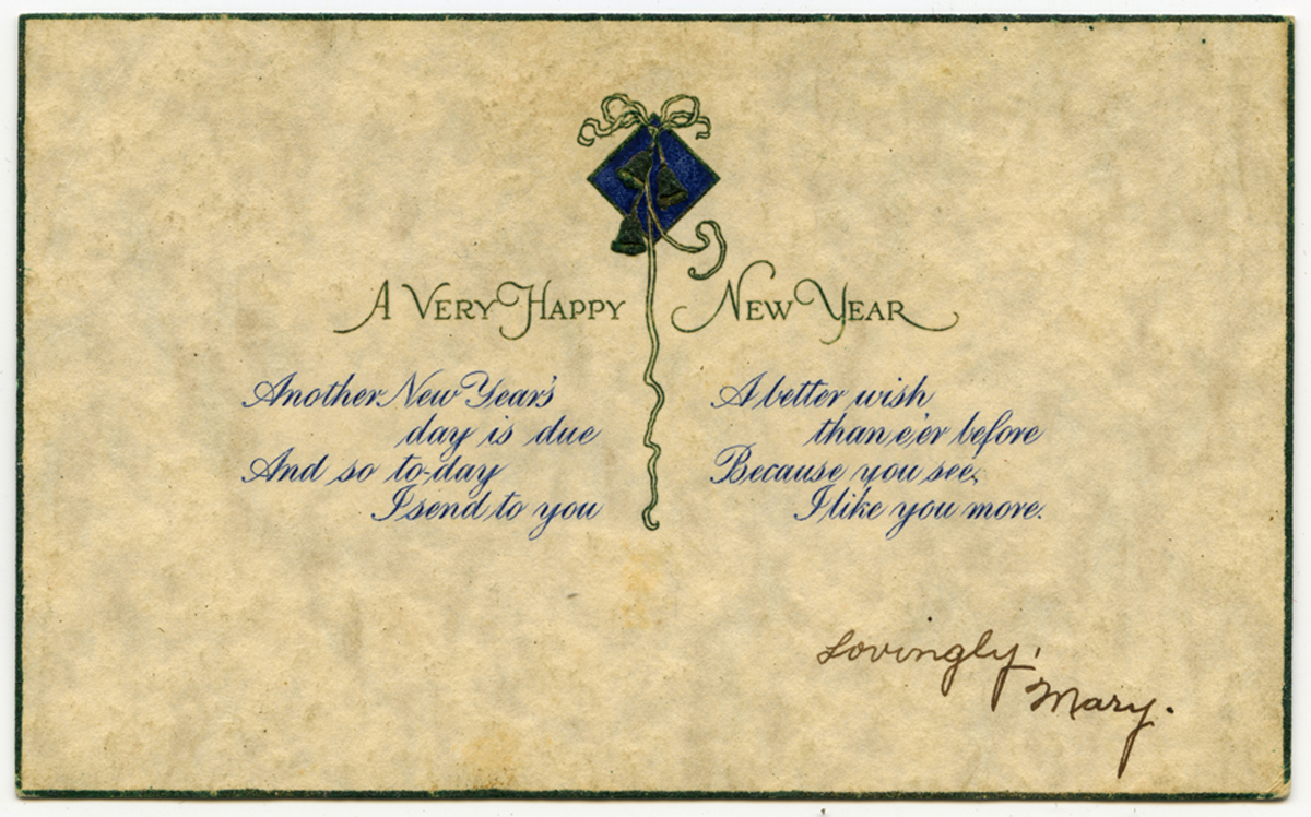
Postcard from Mary Fries to Joe Finney. They were married on November 12, 1919. Many of the postcards in the Finney Collection date to Joe’s time in basic training and his service in France during the last year of Great War.
Kingston first observed Memorial Day — known then as Decoration Day — in 1879. Here are a few images and documents of Kingstonians commemorating those who lost their lives in war.
“8/10/66-KINGSTON, MASS: Brandishing her own protest [sign] Mrs. June A. Ballinger of Kingston pumps mustard-filled water pistol into line of ‘Walk for Peace’ marcher who continued 8/1 their 117-mile march from Boston to Provincetown, Mass., protesti[ng] U.S. involvement in the Viet Nam war. UPI Telephoto”
Kingstonian Horatio Adams has appeared in the Pique of the Week a few times (here, here and here… well, that last one isn’t exactly about him, but it’s a favorite!)
Horatio Adams, 1846-1911
He was an prominent figure in Town history, but who knew he’d be right in the middle of a hot online debate in Kingston today? Read on and you will!
This tale starts with a sizeable parcel of undeveloped privately owned land — 46 acres “more or less” off Winthrop Street — currently under a purchase and sales agreement. Because it falls under Massachusetts’ Chapter 61A laws, the Town of Kingston has the right of first refusal before the sale takes place.
Screen shot of the 46 acres – formally Assessor’s Map 19, Lot 4; Tax Parcel: 019-004-000, from Kingston’s GIS
Some residents are campaigning for the Town to buy the land and keep it as undeveloped open space. Others disagree. In the spirited online discussion of the last few weeks, the question of access to the 46 acre parcel has come up. On maps and plans, it appears land-locked, with no direct connection to Winthrop, Summer or any other public street, a serious obstacle to any use, public or private.
But ah, here’s Horatio’s historical hand…
Detail of Blackwater from Richards’s 1903 Plymouth County Atlas
Through the late 19th and early 20th century, Horatio Adams owned land in and around Blackwater as the area was known, including an icehouse on the pond and four acres of “upland and swamp in Blackwater” with a right of way to Winthrop Street over property to the south.
“Blackwater Pond and Ice House from that part of Winthrop St. (Blackwater Road) called the sand bank or the ‘dug-way’.” Photo by Emily Fuller Drew, circa 1925
Parcel 3 … including specifically a ‘right of way for wagons from the granted premises Southerly over land of Standish to an old road (Winthrop Street) running East and West through land of Ellen Standish’ granted in Deed of Ellen Standish to Horatio Adams dated May 3, 1889.
This deed signed 132 years ago shows that the 46 acres is not land-locked; there is deeded egress to the south. But where exactly is the “land of Standish” over which his wagons could roll?
“House on Winthrop Street (Kingston near Blackwater Pond.) Built by Isaac Holmes before 1714 (see Plym Co Deeds 102-384, (1714) Later owned by Ben Sampson.” Photo by Emily Fuller Drew, circa 1925. Note that this is the current 27 Winthrop.
That 2019 deed (Book 52134, Page 218) shows the sale “subject to other easements, restrictions and reservations of record.” One of those easements appears in a note on a 2003 survey (Plan Book 46, Page 6899) for an earlier subdivision of the original 27 Winthrop. It reads
Locus is subject to existing right of way and drainage rights from land northerly of the locus, as set forth in Bk 576 – Pg 444.
That is, of course, Horatio’s 1889 deed with Ellen Standish. The right of way it established is called out both in the current purchase and sales agreement, and in the deed that transferred the 46 acres to its current owner (Book 3981, Page 476), and a number of other recorded instruments over the years. This 132 year-old easement affects 27 Winthrop, the 1.15 acres, and the other subdivided lots south of the 46 acres.
An annotated detail from Kingston’s GIS
In a final twist, the purchaser of the 1.15 acre parcel was an LLC organized just two months before the sale. Its manager? None other than the purchaser in the pending agreement to buy the 46 acres.
More to come as this interesting situation unfolds…
In a post to the Kingston Town Locals group on Facebook , Will Perry described a recently uncovered 1810 document that describes the line between Pembroke and Kingston. It appears to be a “Notice of Perambulation” documenting a joint walk along the border by the Selectmen of both Towns. By law, Towns should perambulate every five years.
Early land descriptions can be tricky to read, but this map from the The Atlas of the Boundaries of the Town of Kingston shows the Pembroke-Kingston line as it was in 1899. Admittedly, that’s almost a century later, but the “corners” in the notice very likely correspond to stones 8, 9, 10, and 11 on the map. In the Atlas, stone 11 is described as W.M., a witness marker. This post has more information on Kingston’s boundaries and photographs of a couple of witness markers.
Transcription
We the subscribers, Selectmen of the Towns of Pembroke and Kingston, having this day run and reviewed the line between the said Towns and find the corners and distances as follows. Viz
Beginning at a stake and stone by the Jones River Pond [Silver Lake] marked KP thence North 41 1/2 East 110 rods to a stake marked KP in the North-westerly corner of the land of Jedidiah Holmes, thence North 87 Degrees East 349 Rods to a stake and stones marked PK in the line between Jacob Fish and Zachary Fish, by a small run of water, thence South 69 Degrees East 108 rods to a stake and stones by Pine Brook marked KP in Duxbury line
December 14th 1810
Kilborn Whitman, [Isaac?] Hatch, Selectmen of Pembroke
John Faunces, Elisha Hall, Selectmen of Kingston
Naval Constructor Melvin Simmons, born in Kingston on April 19, 1806, served as Master Carpenter for the first steam (or screw) frigate the USS Merrimack. Launched in June 1855 from the Charlestown Navy Yard, she was christened by Simmons’ daughter Mary Elizabeth, then 23.
When Virginia seceded from the Union in 1861, the US Navy burned the Merrimack, then trapped in Norfolk, to prevent her capture. A month later, the Confederates raised the hull, re-built her as the iron-clad ram CSS Virginia, and in 1862, sent her into battle with the Union’s iron-clad, the USS Monitor in Hampton Roads.
Simmons also served at Philadelphia Naval Yard, and ultimately returned to Charlestown as Naval Constructor in the Construction Corps of the Bureau of Construction and Repair. Created in 1866, the Corps gave former civilian employees a formal rank in the US Navy. Simmons’ son Frederick, then an unmarried clerk, was drafted into the Union Army in 1863. He served in the 35th Infantry, until his death on January 1, 1865 in Salisbury, North Carolina.
Melvin Simmons died in Charlestown on May 13, 1871, of apoplexy. He is buried in the Forest Hills Cemetery beside his wife Mary A. (Chase) Simmons, who lived in Kingston at the time of her death on May 10, 1890.
“Elder’s Spring was the water supply for the house-holds of Isaac Allerton, the Mayflower Pilgrim, and of other occupants of the farm, until it came into possession of Elder Thomas Cushman, for whom the present name was given. The old spring was a lovely spot, shaded by huge willows, and boiling up from clean, white sand, a strong and steady flow. A generation ago, Mr. John Bagnell, to make a fish or duck pool, dug away the bank, cut down the willows, and so changed the surroundings of the spring, it is quite different from what it used to be.”
Source: Emily Fuller Drew Collection MC16; quote from her notes on place names in Kingston.