A new idea, from 101 years ago.

Kingston Photo of people buying and selling produce at the Community Market, 1917


In 2018, a new farmer’s market opened in Kingston. The Library’s usually there; check us out! It’s a great new venture with some interesting echos of the past.

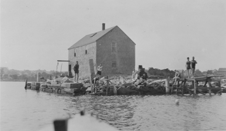
In  1917, Kingston also had a new community market, this one located at the Point, right where Summer Street splits from Main. The Old Colony Memorial on July 13 that year invited anyone with surplus food  to join in.

No matter how small an amount you may have to sell, you are invited to bring it to the market. Products of the garden, dairy, poultry, etc. in fact, anything you are engaged in producing…

Part of the national effort to increase local food production as the nation entered the First World War, Kingston’s market was sponsored by the Grange, the Patriotic Society and the Food Production Committee of the Public Safety Commission. There was no charge for selling: vendors just had to show up with their wares.

Within the first week the market was open, 17-year-old diarist Helen Foster wrote that “things sure were stirring there.”

Source:  Newspapers PC19; Mary Hathaway Collection MC21

Summer Street, 1927

In March 1927, Emily Fuller Drew (seen here in her Tercentenary costume) took these photos of Summer Street, looking south toward the center of Town, just after Town Meeting voted to widen the street.Houses on Summer Street, Kingston, in 1927Houses on Summer Street, Kingston, in 1927 Houses on Summer Street, Kingston, in 1927

Summer Street had been previously straightened and/or widened in 1846, 1856, 1905 and 1922, when a number of very early houses around the Point fell victim to highway work.

This time the casualties were the gracious trees that lined and shaded the street.  Emily wrote “Maples and elms lined our Summer Street in the old days..the green tunnel which was our street before the trees were cut down in 1927, to allow for widening the thorofare. Summer Street was the Boston Road which superseded the Bay Path as a highway from Plymouth to Boston.”

Her cousins Mary W. Drew and Jennie McLauthlen (Kingston’s first librarian) made their position clear in this handbill, but to no avail: the proposal was approved, the street widened, and the trees all taken down.

Handbill about the removal of trees required by a proposed project to widen Summer Street, March 1927

Sources: Photos from the Emily Fuller Drew Collection MC16. Handbill from Vertical Files OC2 “Summer Street.” Additional information from Street Files TOK6 “Summer Street.”

In other spelling news

Gray’s Beach Park is named for Edward Gray, who arrived in Plymoth Colony in the 1642 and eventually became one of the the richest men around. He owned land along what later became Kingston’s shoreline, including as this notable land record,  the site of  Kingston’s little beach.

And we know it’s Gray’s with an A, because, yes, it’s carved in stone.

Gravestone of Edward Gray in Plymouth cemetery

This is Old Burial Hill in Plymouth, and Gray’s is one of the oldest marked stones there. The more legible of the two markers is actually a sign pointing to the original stone, which appears to be  in some kind of protective frame.  The related page on Find-a-Grave has some good modern close ups of the actual stone.

Source: The Jones River Village Historical Society Lantern Slide Collection IC4, series “The Pilgrim Story, Plymouth” 90 slides copyright A. S. Burbank, circa 1920.

And the correct spelling is…

Brochure for land sales at Ah-De-Nah, in Kingston, around 1930


Here’s a detail of an early brochure for the summer cottage development called Ah-De-Nah, circa 1930.  The name was pitched as a Native American term, but descendants of the developers, Edgar and Waldo Loring, might tell you it was just made up.

Welcome Home!

Kingston Town House decorated for Welcome Home Day, 1919

Why, thank you!
It’s good to be back.

Watering trough at the Point

The Henry R. Glover Water Trough at the Point, Main Street and Summer Street, c. 1925

In 1888, Henry R. Glover, a wealthy manufacturer of mattresses and “curled hair” from Cambridge, donated the “Henry Glover Watering Trough” to the town for public use. It was placed, and remains, at the Point, that triangular plot of land at the intersection of Main and Summer Streets. Glover was the son of Rev. Samuel Glover, a Baptist minister, who raised his family in the Samuel Foster House on Summer Street opposite the Point. The trough was a place for horses and dogs to drink after the town dismantled and covered the Point Well.


Source: Image from the Local History Room Image Collection IC7.

What a mustache!

The following is a portrait of Frederick G. Brackett (1854-1941). In 1889, he purchased the house at 126 Brookdale Street, built by the Chandler family around 1790, along with the sawmill located off Hall’s Brook just east of the house.

Portrait of Fred Brackett, undated

Brackett continued to operate the mill (which burned down in 1924) and started a cranberry business with Samuel Lowe on the east side of Brookdale Street.

Brackett's Pond, mill yard, and sawmill, c. 1920
Brackett’s Pond, mill yard, and sawmill, c. 1920

And he had an enormous mustache.


Sources: Images from the Local History Room Image Collection IC7 and the Emily Fuller Drew Collection MC16.